
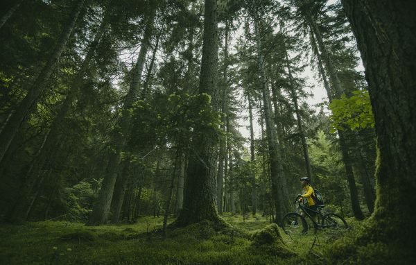
All 35+ Protected Sites: National Parks, Nature Reserves, Managed Reserves, and Natural Monuments
Georgia’s protected-area network includes national parks, strict nature reserves, managed reserves, natural monuments and protected landscapes, covering roughly 12% of the country. The official inventory can change as new sites are designated or reclassified.
This guide covers every significant protected area in Georgia with practical information for travelers: what makes each site special, how to get there, what trails or activities to expect, and when to visit.
Understanding Georgia’s Protected Area Categories
Before diving into individual sites, it helps to understand how Georgia classifies its protected lands:
National Parks allow tourism and recreation while protecting ecosystems. These are the most visitor-friendly areas with marked trails, shelters, and visitor centers.
Strict Nature Reserves (ნაკრძალი) prioritize scientific research and biodiversity preservation. Tourism is limited or prohibited without special permits.
Managed Reserves (აღკვეთილი) permit sustainable use, including controlled tourism, grazing, or forestry under park management.
Natural Monuments protect specific geological, hydrological, or botanical features like caves, waterfalls, or ancient trees.
Protected Landscapes conserve cultural landscapes where human activity and nature have interacted over centuries.
Quick Reference: All Protected Areas by Region
Kakheti Region
| Protected Area | Type | Size (ha) | Highlights |
|---|---|---|---|
| Lagodekhi | National Park + Reserve | 24,451 | Black Rock Lake, virgin forest, waterfalls |
| Vashlovani | National Park + Reserve | 35,054 | Semi-desert, mud volcanoes, striped hyena |
| Tusheti | National Park | 122,634 | Stone towers, Omalo, Abano Pass |
| Batsara-Babaneuri | Nature Reserve | 3,812 | Yew groves, virgin forest |
| Ilto | Managed Reserve | 5,273 | Buffer zone, oak forest |
| Chachuna | Managed Reserve | 5,200 | Semi-desert ecosystem |
| Korugi | Managed Reserve | 4,096 | Juniper woodland |
| Mariamjvari | Nature Reserve | 1,040 | Juniper ecosystem |
| Iori | Managed Reserve | 1,648 | Floodplain forest |
Samtskhe-Javakheti Region
| Protected Area | Type | Size (ha) | Highlights |
|---|---|---|---|
| Borjomi-Kharagauli | National Park | 85,083 | Largest park, 12 trails, horse riding |
| Javakheti | National Park | 14,313 | Highland lakes, bird migration |
| Nedzvi | Managed Reserve | 12,221 | Buffer for Borjomi park |
| Ktsia-Tabatskuri | Managed Reserve | 22,000 | Lake ecosystem, cranes |
| Goderdzi Petrified Forest | Natural Monument | 10 | 40-million-year-old fossils |
Adjara Region
| Protected Area | Type | Size (ha) | Highlights |
|---|---|---|---|
| Mtirala | National Park | 15,698 | Rainforest, 4,500mm rainfall |
| Machakhela | National Park | 12,736 | Arched bridges, subtropical |
| Kintrishi | Nature Reserve | 13,893 | Canyon, endemic flora |
| Kobuleti | Managed Reserve | 770 | Wetlands, Ispani peat bogs |
Mtskheta-Mtianeti Region
| Protected Area | Type | Size (ha) | Highlights |
|---|---|---|---|
| Kazbegi | National Park | 8,700 | Gergeti Church, Mt. Kazbek |
| Pshav-Khevsureti | National Park | 76,850 | Shatili, Abudelauri lakes |
| Tbilisi | National Park | 23,571 | Saguramo forest |
| Saguramo | Nature Reserve | 5,247 | Forest near capital |
| Liakhvi | Managed Reserve | 6,388 | River valley |
Imereti Region
| Protected Area | Type | Size (ha) | Highlights |
|---|---|---|---|
| Imereti Caves | Protected Area | 12,876 | Prometheus, Sataplia caves |
| Ajameti | Managed Reserve | 4,848 | Oak and zelkova forest |
| Kharagauli | Managed Reserve | 4,620 | Part of the Borjomi system |
Samegrelo and Guria Regions
| Protected Area | Type | Size (ha) | Highlights |
|---|---|---|---|
| Kolkheti | National Park | 44,613 | UNESCO wetlands, 190 bird species |
| Paliastomi | Natural Monument | 1,500 | Coastal lake |
| Pichori River | Protected Area | 640 | Wetland ecosystem |
Kvemo Kartli Region
| Protected Area | Type | Size (ha) | Highlights |
|---|---|---|---|
| Algeti | National Park | 6,822 | Day trips from Tbilisi |
| Gardabani | Managed Reserve | 3,500 | Tugai forest |
| Dashbashi Canyon | Natural Monument | N/A | Diamond Bridge |
The Big Five: Most Popular Protected Areas
These five sites receive the most visitors and offer the best infrastructure for independent travelers.
1. Borjomi-Kharagauli National Park
Full guide: 12 Hiking Trails in Borjomi-Kharagauli
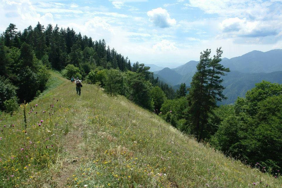
Borjomi-Kharagauli covers over 85,000 hectares across the Lesser Caucasus mountains, making it one of the largest protected areas in Europe. The park ranges from 400 meters in the Borjomula River valley to 2,642 meters on the highest ridges.
WWF Germany helped establish the park in 1995, and it became Georgia’s first protected area to meet international IUCN standards. The park administration manages four distinct protected zones: Borjomi Nature Reserve, the National Park itself, Nedzvi Managed Reserve, and Goderdzi Fossil Forest Natural Monument.
Why go: The park preserves old-growth forest that disappeared from most of Europe centuries ago. Oriental spruce, Nordmann fir, and beech trees grow here undisturbed. Wildlife includes brown bear (estimated 50 to 60 individuals), wolf, lynx, chamois, and roe deer. The Caucasian grouse, found nowhere else on earth, breeds in the subalpine meadows between 2,200 and 2,600 meters.
Trail network: The park maintains 12 marked trails covering about 300 kilometers total.
Most popular routes:
- Likani to Lomis Mta (3 days, 43 km): Classic traverse with overnight stays in ranger shelters at Lomismta (1,920m) and Sakhvlari (1,780m)
- Amarati Loop from Atskuri (2 days, 34 km): Passes the bezoar goat reintroduction enclosure and offers panoramic views of the Lesser Caucasus
- Nikoloz’s Trail (1 day, 13 km one way): Named after Grand Duke Nikoloz Romanov, easy gradient from Likani guard station
- St. Andrew’s Trail (1 day, 6 km loop): Shortest option, family-friendly, starts from Borjomi visitor center
Practical information:
| Detail | Information |
|---|---|
| Visitor centers | Borjomi (main), Kharagauli, Atskuri |
| Registration | Required, free at visitor centers |
| Shelter fee | Confirm the current rate with the visitor centre. |
| Camping fee | 5 GEL per person per night |
| Tent rental | 10 GEL per day |
| Sleeping bag rental | 5 GEL per day |
| Horse rental | From 60 GEL per horse per day; route and instructor fees vary. |
| Bicycle rental | 35 GEL per day |
| Snowshoes | 15 GEL for the first day; 10 GEL for each additional day |
| Transport from Tbilisi | Fares and schedules vary; confirm before travel. |
| Coordinates (Borjomi VC) | 41.8389°N, 43.3917°E |
| Phone | +995 577 101 895 |
| ltabunidze@apa.gov.ge |
When to go: Late May through October. July and August can be hot at lower elevations. September brings the best weather and fall colors. Winter visitors can use snowshoes on designated routes.
Nearby attractions: Borjomi town and mineral springs, Green Monastery (Chitakhevi), Likani Palace, sulfur pools
2. Lagodekhi Protected Areas
Full guide: Lagodekhi National Park
Lagodekhi sits in the far northeast corner of Georgia against the Dagestan border. Established in 1912 by Polish naturalist Ludwik Mlokosiewicz, it ranks among the oldest protected areas in the former Russian Empire.
The protected area comprises two zones: Lagodekhi Strict Nature Reserve (19,749 ha) where only scientific research is permitted, and Lagodekhi Managed Reserve (4,702 ha), where tourism takes place. The reserve climbs from 590 meters at the entrance to 3,500 meters at the main Caucasus ridge.
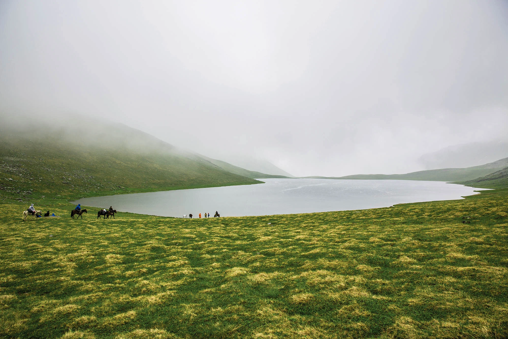
Why go: Lagodekhi feels genuinely wild. Trails lead through virgin forest where trees reach 50 meters tall. East Caucasian tur (wild mountain goat), chamois, and occasional Persian leopard inhabit the higher elevations. Over 120 bird species nest here. The signature destination is Black Rock Lake (Shavi Klde), a glacial tarn at 2,800 meters surrounded by jagged peaks.
Trail network: Five marked trails ranging from 3-hour walks to 3-day treks.
| Trail | Distance | Duration | Difficulty |
|---|---|---|---|
| Ninoskhevi Waterfall | 7 km round trip | 3 to 4 hours | Easy |
| Rocho (Great) Waterfall | 9.5 km round trip | 4 to 5 hours | Moderate |
| Black Rock Lake | 45 km round trip | 2 to 3 days | Hard |
| Machi Fortress | 16 km round trip | 1 day | Moderate |
| Nature Trail (children) | 600 m loop | 30 minutes | Easy |
| Detail | Information |
|---|---|
| Visitor center | Lagodekhi town, Vashlovani St. 17 |
| Registration | Required; passport copy needed for border zone trails |
| Shelter fee | Confirm the current rate with the visitor centre. |
| Camping fee | Confirm the current rate with the visitor centre. |
| Tent rental | Confirm the current rate with the visitor centre. |
| Horse rental | Confirm the current rate with the visitor centre. |
| Transport from Tbilisi | Fares and schedules vary; confirm before travel. |
| Coordinates | 41.8267°N, 46.2783°E |
| Phone | +995 577 101 890 |
| Season | Most trails April to October; Black Rock Lake June to September |
When to go: June for wildflowers including the endemic golden lily (Lilium mlokosewitschii). September for stable weather and fewer crowds. The Black Rock Lake trail opens in late June when snow melts from the passes.
3. Vashlovani Protected Areas
Related tour: Vashlovani and Signagi Tour
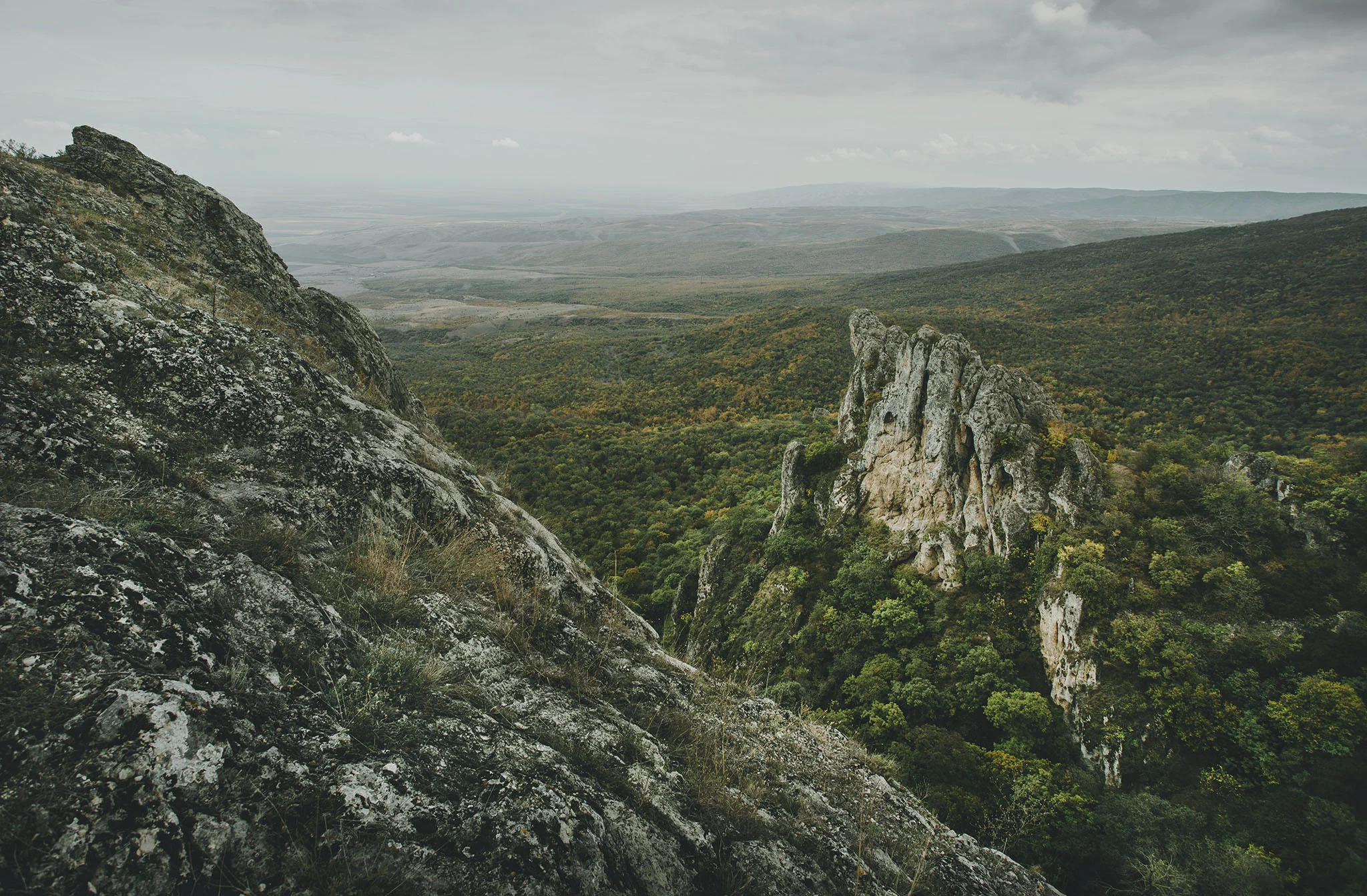
Vashlovani occupies the far southeast corner of Georgia near the Azerbaijan border. The landscape looks nothing like the rest of the country: semi-arid badlands, pistachio woodlands, and dramatic erosion features create scenery reminiscent of the American Southwest or African Sahel.
The protected area includes Vashlovani National Park, Vashlovani Strict Nature Reserve, Chachuna Managed Reserve, and three natural monuments: Eagle Gorge (Artsivi Khevi), Takhti-Tepa Mud Volcanoes, and Alazani River floodplain forest.
Why go: This is the only place in Georgia where you might see striped hyena, one of Europe’s rarest large carnivores. The park also supports golden jackal, wolf, wild boar, and possibly Persian leopard. Spring brings spectacular wildflower displays: wild tulips (Tulipa eichleri), Georgian irises, and steppe peonies carpet the hillsides in April.
Activities: Most exploration happens by 4×4 vehicle. Walking trails exist, but distances between points of interest require vehicle support.
| Safari Route | Duration | Highlights |
|---|---|---|
| Visitor Center to Khornabuji to St. Elias Mountain | Half day | Fortress ruins, mountain views |
| Takhti-Tepa Mud Volcanoes | Half day | Active mud volcanoes |
| Vashlovani to Pantishara to Bear Gorge | Full day | Canyon landscape, wildlife |
| Black Mountain to Kakliskure | Full day | Floodplain forest, border views |
When to go: Late March to May for wildflowers and comfortable temperatures. September to November for mild weather, bird migration, and mastic tree fruiting. Avoid summer when temperatures exceed 40°C.
Best seasons for specific activities:
- Wildflower photography: April to mid-May
- Birdwatching: April and October to November
- Sport fishing: April to July
4. Kazbegi National Park
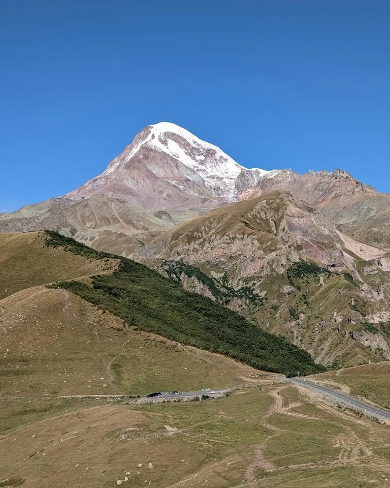
Related tours: One-day Kazbegi trip
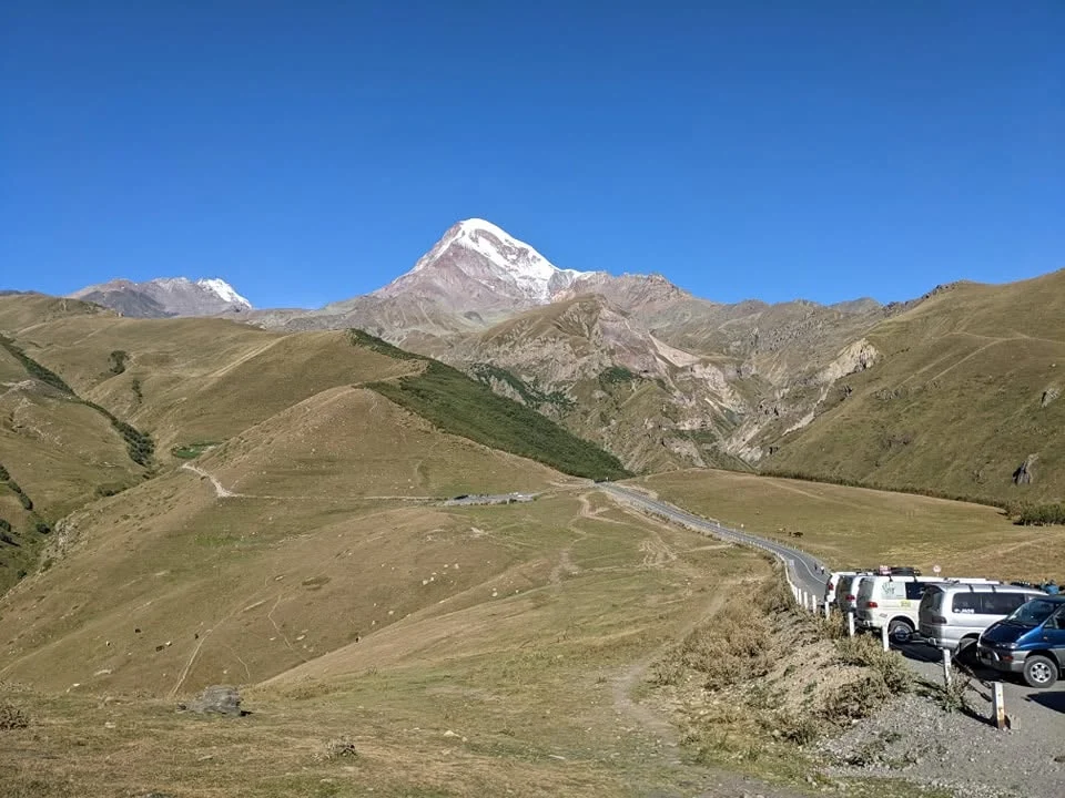
Kazbegi National Park protects the Georgian slopes of Mount Kazbek (5,054 m), the country’s third-highest peak. The park centers on Stepantsminda (still commonly called Kazbegi), a small town that serves as a base for day hikes, glacier treks, and summit attempts.
The Gergeti Trinity Church, perched at 2,170 meters with Kazbek’s icy pyramid behind it, has become the defining image of Georgian tourism. The drive from Tbilisi along the Georgian Military Highway ranks among the great mountain roads of the world.
Why go: Easy access to genuine high-altitude terrain without technical climbing. You can walk from town to the Gergeti Glacier tongue in a single day. The Truso Valley, accessible from the eastern edge of the park, offers mineral springs, travertine formations, and an abandoned village.
Trail options:
| Trail | Distance | Duration | Elevation Gain |
|---|---|---|---|
| Gergeti Trinity Church | 6 km round trip | 2 hours up, 1.5 down | 500 m |
| Gergeti Glacier | 18 km round trip | 5 to 7 hours | 1,100 m |
| Truso Valley | 20 km round trip | 6 to 8 hours or overnight | 400 m |
| Juta to Abudelauri Lakes | 16 km round trip | 6 to 8 hours | 900 m |
| Mount Kazbek summit | 2 to 3 days | Technical | 3,000 m+ |
| Detail | Information |
|---|---|
| Visitor center | Stepantsminda, near central square |
| Registration | Required for Truso Valley (border zone) |
| Mountain guides | Private-service rates vary; request a current quote. |
| Horse rental | Private-service rates vary; request a current quote. |
| 4×4 to Gergeti Church | Private-service rates vary; request a current quote. |
| Transport from Tbilisi | Private-service rates vary; request a current quote. |
| Coordinates | 42.6619°N, 44.6439°E |
5. Tusheti National Park
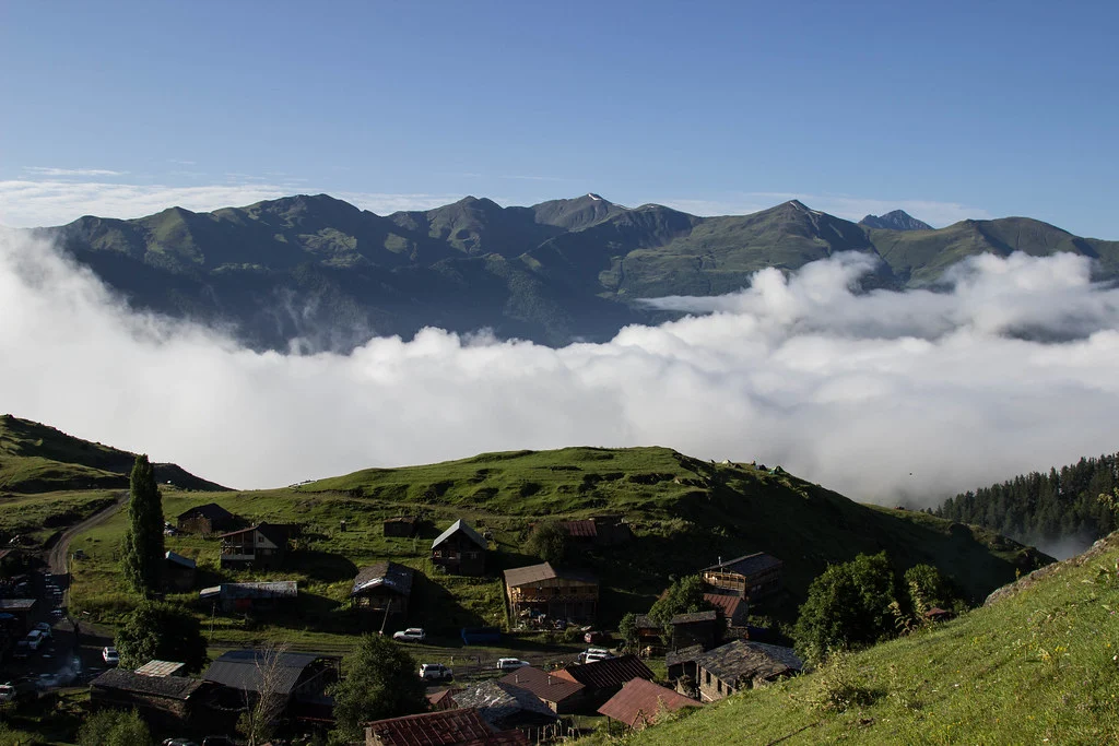
Full guide: Why Travel to Tusheti National Park
Related tour: Horse Riding in Tusheti
Tusheti sits at the end of one of the most dangerous roads in the world. The Abano Pass (2,926 m) closes from October to May, isolating the region for seven months each year. Only a few hundred people remain in winter; the rest migrate to Kakheti lowlands with their sheep.
The park covers 122,634 hectares of high mountain terrain, making it Georgia’s largest national park. Stone defense towers dot the villages, built centuries ago against Dagestani and Chechen raiders. The entire region is on UNESCO’s tentative list for World Heritage status.
Why go: Authentic medieval mountain culture that survives in few places on earth. Stone villages like Dartlo and Diklo look unchanged since the 15th century. Multi-day treks connect to Khevsureti via the Atsunta Pass (3,487 m). The region is part of the Tusheti, Batsara-Babaneuri, Lagodekhi, and Vashlovani Protected Areas complex.
Key villages:
- Omalo: Administrative center with museum, guesthouses, helipad
- Dartlo: Best-preserved architecture, stone towers
- Shenako: Ancient church with frescoes, community museum
- Diklo: Border village, Pichekhi fortresses, dramatic location
- Parsma, Chesho, Kvavlo: Remote villages in Pirikita gorge
| Route | Duration | Vehicle Required | Season |
|---|---|---|---|
| Telavi to Omalo via Abano Pass | 5 to 6 hours | 4×4 mandatory | Late June to mid-October |
| Helicopter from Telavi | 20 minutes | Charter | Year-round (weather permitting) |
| Atsunta Pass from Khevsureti | 2 to 3 days trekking | On foot | July to September |
IMPORTANT WARNING: Pork and pork products are strictly forbidden in Tusheti. This is an ancient tradition that locals take very seriously. Do not bring any pork items.
Practical information:
| Detail | Information |
|---|---|
| Visitor center | Omalo (seasonal) |
| Registration | Required for trekking |
| Guesthouse accommodation | Private-service rates vary; request a current quote. |
| Horse rental | Private-service rates vary; request a current quote. |
| 4×4 hire from Telavi | Private-service rates vary; request a current quote. |
| Helicopter charter | On request (expensive) |
When to go: July to mid-September only. The road typically opens in late June and closes with the first heavy snows in October. August offers the most stable weather but also the most visitors.
Regional Deep Dives
Adjara: Subtropical Parks
Adjara’s parks protect some of Europe’s wettest and most biodiverse forests.
Mtirala National Park
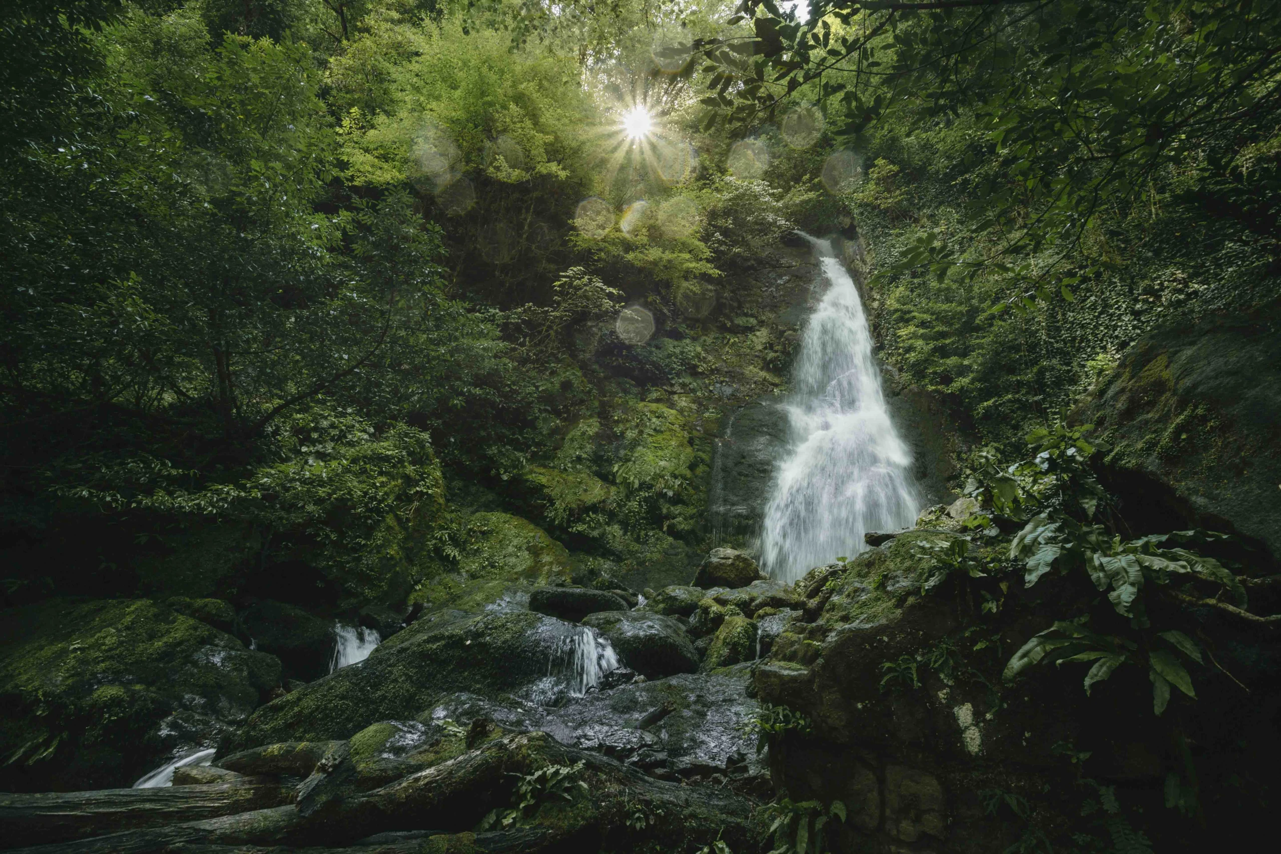
Mtirala receives over 4,500 mm of rain annually, making it one of the wettest spots in Europe. The park’s name means “crybaby” in Georgian because of the constant dripping from trees.
The park preserves Colchic forest, a relic ecosystem that survived the Ice Ages in the mild coastal climate. Some plant species here date back 15 million years. Ancient boxwood groves, wild tea bushes, and endemic rhododendrons fill the understory.
Trails:
- Visitor Center to Tourist Shelter: 9 km each way, 3 hours up
- Tsablnari Waterfall Loop: 4 km, 2 hours
- Zip-line: 200 m; confirm the current price with the park visitor centre.
Access: Taxi from Batumi (fare varies; confirm before travel) to the Chakvistavi village visitor center
When to go: May to October, but expect rain year-round. Bring waterproof gear.
Machakhela National Park
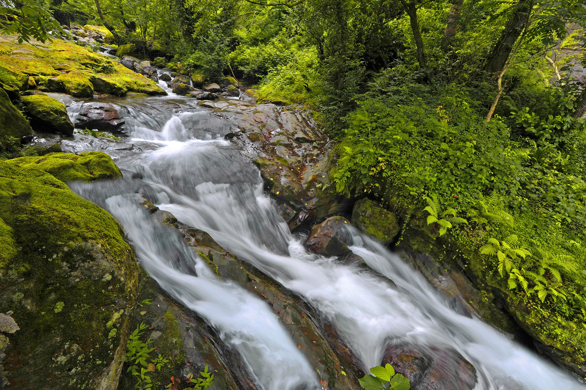
Tucked into the hills behind Batumi, Machakhela protects a river valley famous for arched stone bridges and subtropical forest. The region has historical significance as a buffer zone between Georgian and Ottoman territories.
Highlights: Makhuntseti Waterfall (with famous arched bridge), Queen Tamar’s Bridge, traditional mountain villages, tea plantations
Access: 45 minutes from Batumi by car
Kintrishi Protected Areas
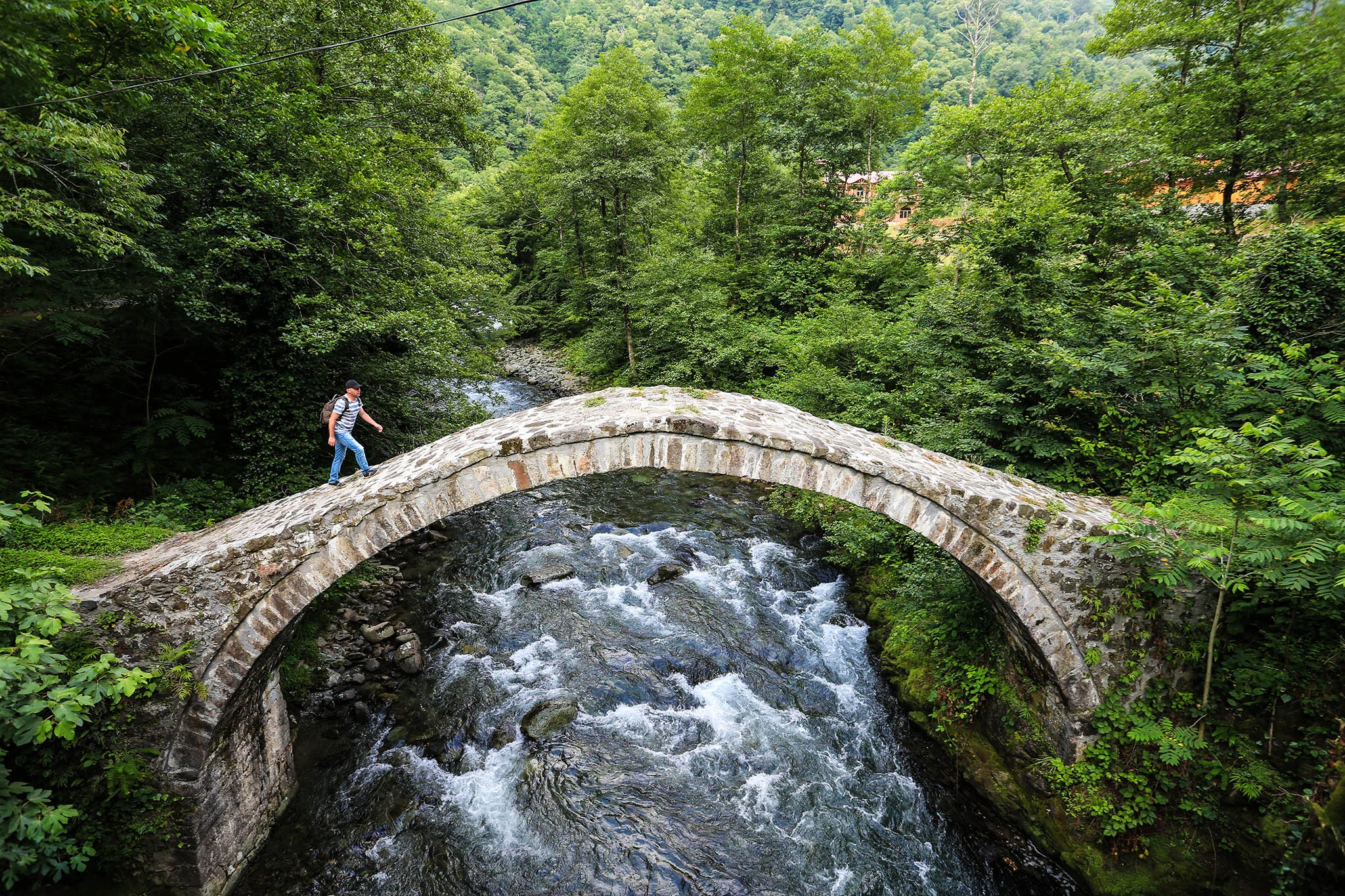
Deep gorges, waterfalls, and some of the least-visited trails in western Georgia. The Kintrishi River has carved dramatic canyons through the landscape.
Why go: Genuine wilderness close to Batumi without the crowds. Endemic Colchic flora, including ancient chestnut groves.
Access: 1.5 hours from Batumi
Kobuleti Managed Reserve
Coastal wetlands including the unique Ispani Sphagnum Peatlands, one of the few raised bogs in the Caucasus region.
Why go: Rare bog ecosystem, birdwatching, easy boardwalk access
Imereti: Caves and Canyons
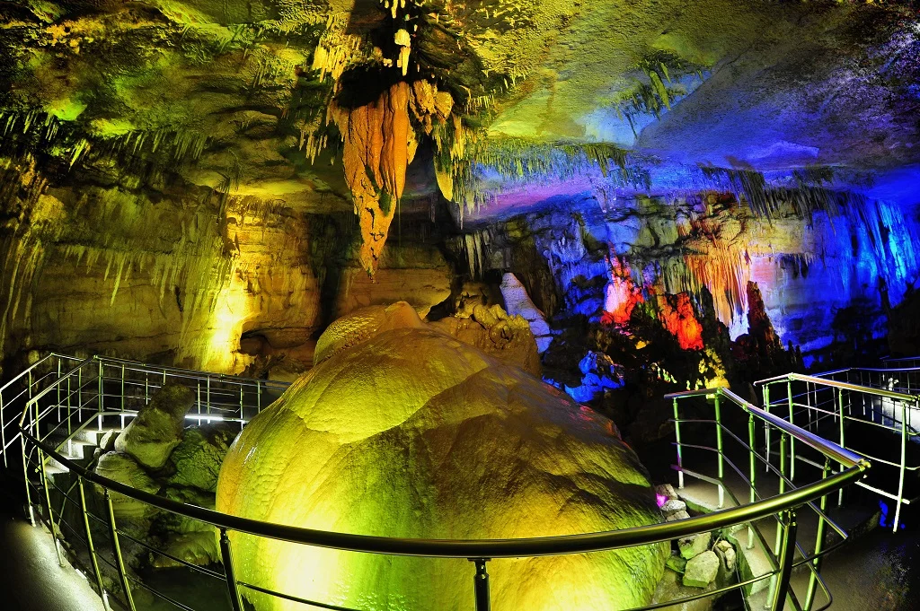
Related: Prometheus Grotto Guide
Imereti Caves Protected Area
Unlike the mountain parks, Imereti protects underground landscapes. The area includes two major cave systems open to tourists:
Prometheus Cave:
- Length: 1.6 km tourist route (full system extends 11 km)
- Features: 6 illuminated halls, stalactites, stalagmites, underground river
- Boat ride: 30 GEL for foreign visitors; 14 GEL for Georgian citizens and residents.
- Entry: 40 GEL for foreign adults; 16 GEL for Georgian citizens and residents; 5.50 GEL for visitors aged 6–18.
- Hours: 10:00–18:00 in spring and summer; 10:00–17:00 in autumn and winter. Confirm the current schedule before visiting.
- Access: 40 km from Kutaisi, near Kumistavi village
- Dinosaur footprints: 120-million-year-old tracks
- Cave: Smaller than Prometheus but atmospheric
- Glass observation deck: Cliff-edge viewing platform
- Entry: 30 GEL for foreign adults; 15 GEL for Georgian citizens and residents; 5.50 GEL for visitors aged 6–18.
- Access: 9 km from Kutaisi
Both caves maintain a constant 14°C temperature year-round. Bring a jacket.
Okatse Canyon
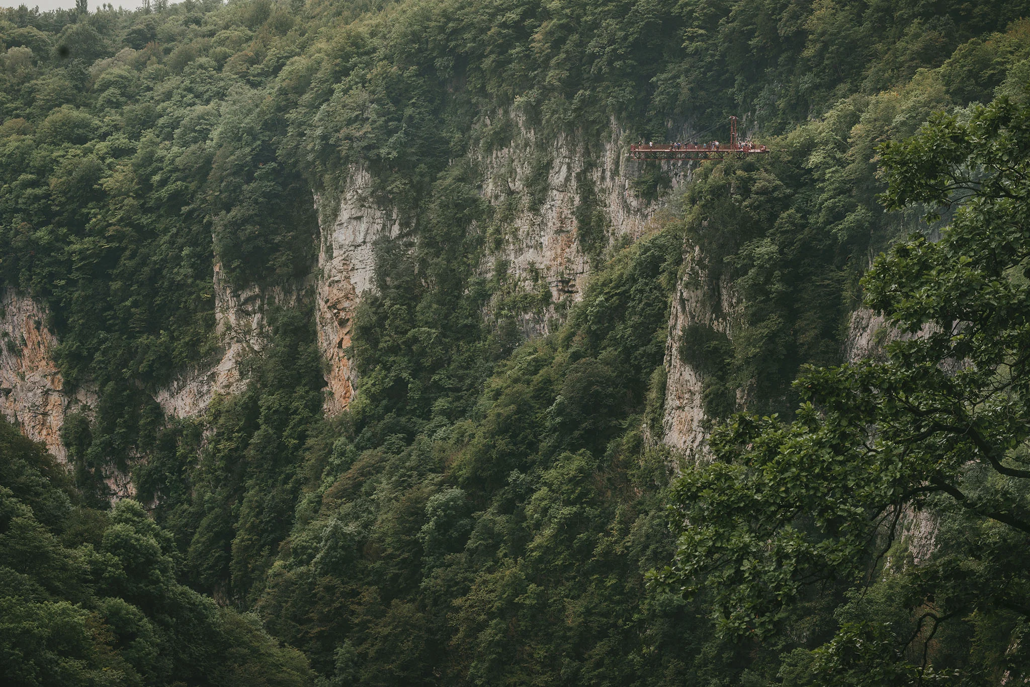
Okatse Canyon offers a completely different experience from Martvili. Rather than boats on water, visitors walk along a suspended metal walkway bolted to the cliff face 140 meters above the canyon floor.
The Okatse River has cut a deep gash through the Colchic limestone plateau, creating sheer walls and a narrow gorge that drops away dramatically beneath your feet. The walkway ends at a cantilevered viewing platform that extends over the void.
The experience:
- Trail from entrance to canyon: 2.2 km through forest
- Suspended walkway: 780 meters along cliff face
- Viewing platform: Glass-floored extension over 140m drop
- Total duration: 2 to 3 hours round trip
- Difficulty: Moderate (significant walking, stairs)
Other protected areas: Tetra Cave, Navenakhevi Cave, Kinchkha Waterfall, and Ajameti Forest.
Kakheti: From Desert to Alpine
Kakheti contains the most diverse range of protected ecosystems in Georgia.
Batsara-Babaneuri Protected Areas
Full guide: Batsara-Babaneuli Protected Areas
Three separate units protecting unique forest ecosystems:
- Batsara Strict Nature Reserve (3,042 ha): Famous yew (Taxus baccata) groves, some trees over 1,000 years old
- Babaneuri Strict Nature Reserve (770 ha): Oak and hornbeam forest
- Ilto Managed Reserve (5,273 ha): Buffer zone, limited tourism permitted
Access: Near Pankisi Gorge, 170 km from Tbilisi. Visits require advance permission for strict nature reserves.
Chachuna Managed Reserve
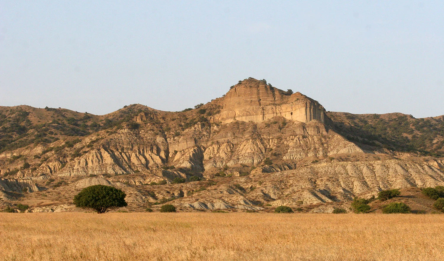
Semi-desert ecosystem similar to Vashlovani but closer to Tbilisi. Pistachio woodlands, tulips in spring, juniper groves.
Access: Near Dedoplistskaro, can be combined with the Vashlovani visit
Iori Managed Reserve
Protects the floodplain forest (tugai) along the Iori River. These gallery forests are rare in the region.
Samtskhe-Javakheti: Highlands and Forests
Javakheti National Park
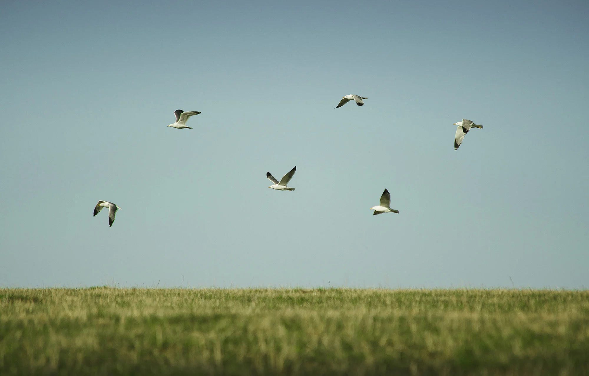
The volcanic highlands of Javakheti contain Georgia’s largest lakes and most important wetlands for migratory birds.
Key sites:
- Lake Paravani: Georgia’s largest lake, 2,073 m elevation, 37.5 sq km
- Sagamo Lake: Important nesting site for waterfowl
- Khanchali Lake: Key stopover for migrating cranes and pelicans
- Madatapa Lake: Border lake shared with Armenia
Why go: Stark, treeless landscapes that feel more like Central Asia. Critical habitat for Dalmatian pelican, Armenian gull, and migrating demoiselle cranes. Archaeological sites including megalithic structures.
Access: 2 hours from Tbilisi
When to go: May to September for general visits. April to May and September to October for bird migration peaks.
Ktsia-Tabatskuri Managed Reserve
High-altitude lake ecosystem at 1,991 meters. Lake Tabatskuri freezes in winter and supports breeding populations of ruddy shelduck and other waterfowl.
Access: Between Tsalka and Akhalkalaki
Mtskheta-Mtianeti: Mountain Adventures
Regional guide: Mtskheta-Mtianeti
Pshav-Khevsureti National Park
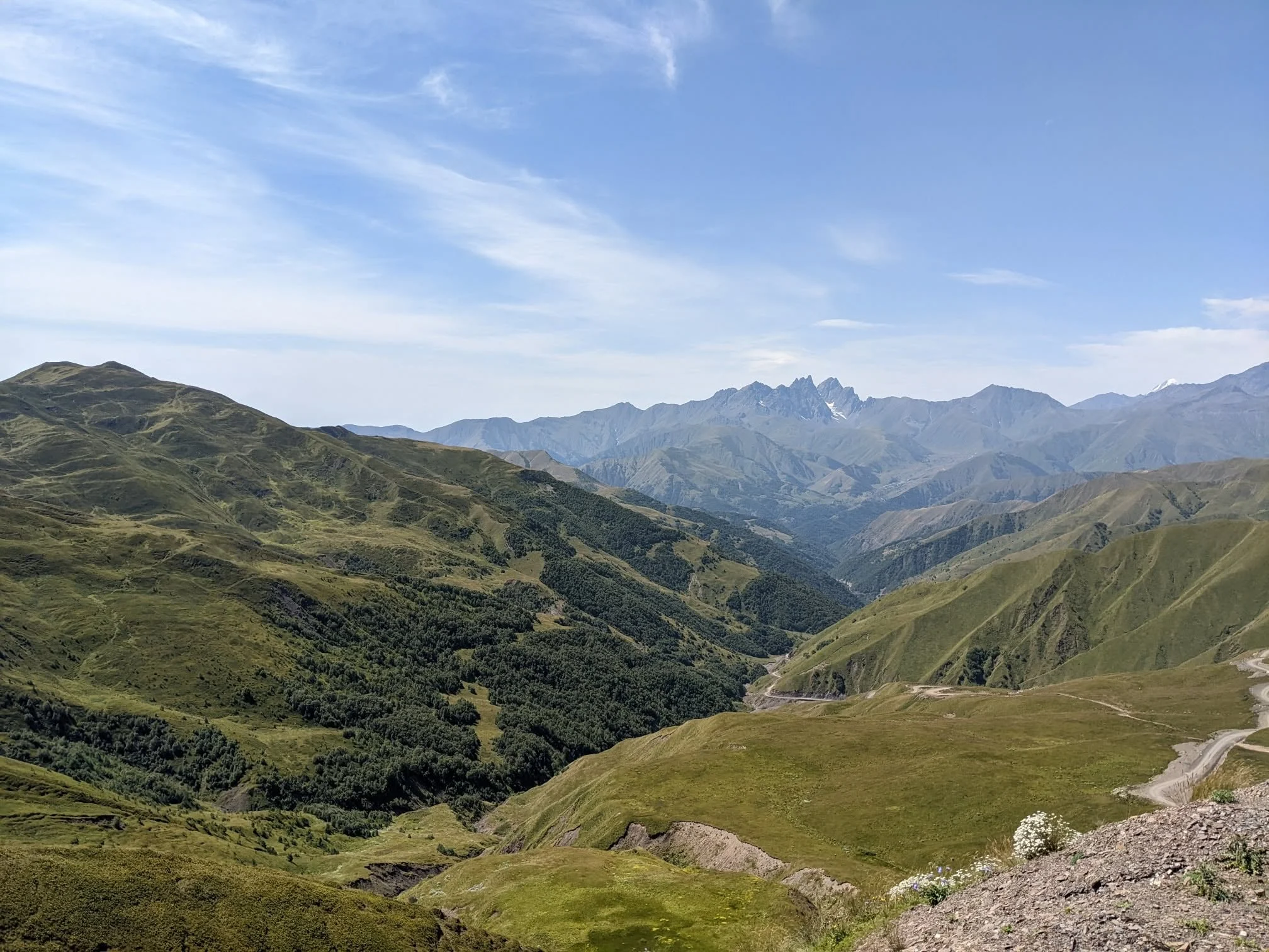
Related tour: 2-Day Tour to Khevsureti
The neighboring region to Tusheti offers equally dramatic landscapes and even more remote villages. The park protects 76,850 hectares of high Caucasus terrain.
Key destinations:
- Shatili: Interconnected fortress village, the most photographed site in Khevsureti
- Mutso: Abandoned cliff-top village with dramatic towers
- Abudelauri Lakes: Three glacial lakes of different colors (green, blue, white)
- Roshka: Gateway village for Abudelauri trek
- Atsunta Pass (3,487 m): Multi-day crossing to Tusheti
Access: 4×4 recommended for Argun gorge. Standard cars can reach Shatili in dry conditions. About 4 hours from Tbilisi.
Season: June to September
Tbilisi National Park
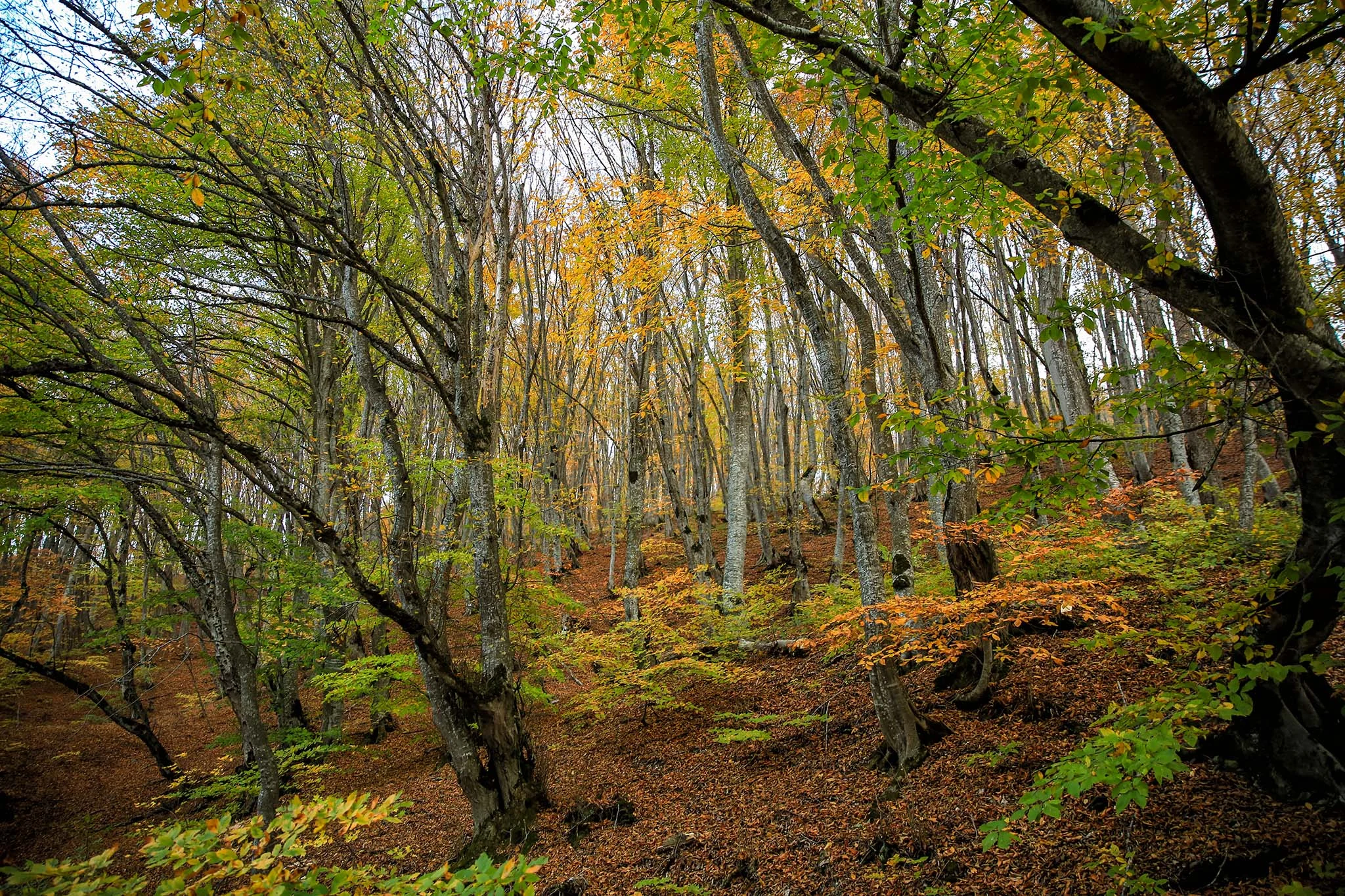
The capital has its own national park stretching across the hills north of the city. The park includes Saguramo forest and the historic Martkopi Monastery.
Highlights: Urban hiking, Saguramo forest trails, Martkopi Monastery, proximity to city
Access: Multiple entry points from Tbilisi and the surrounding suburbs
Season: Year-round
Saguramo Nature Reserve
Strict nature reserve within the Tbilisi National Park system. Limited access for research purposes.
Samegrelo: Canyons and Wetlands
Western Georgia’s Samegrelo region offers dramatic canyons and internationally important wetlands along the Black Sea coast.
Martvili Canyon
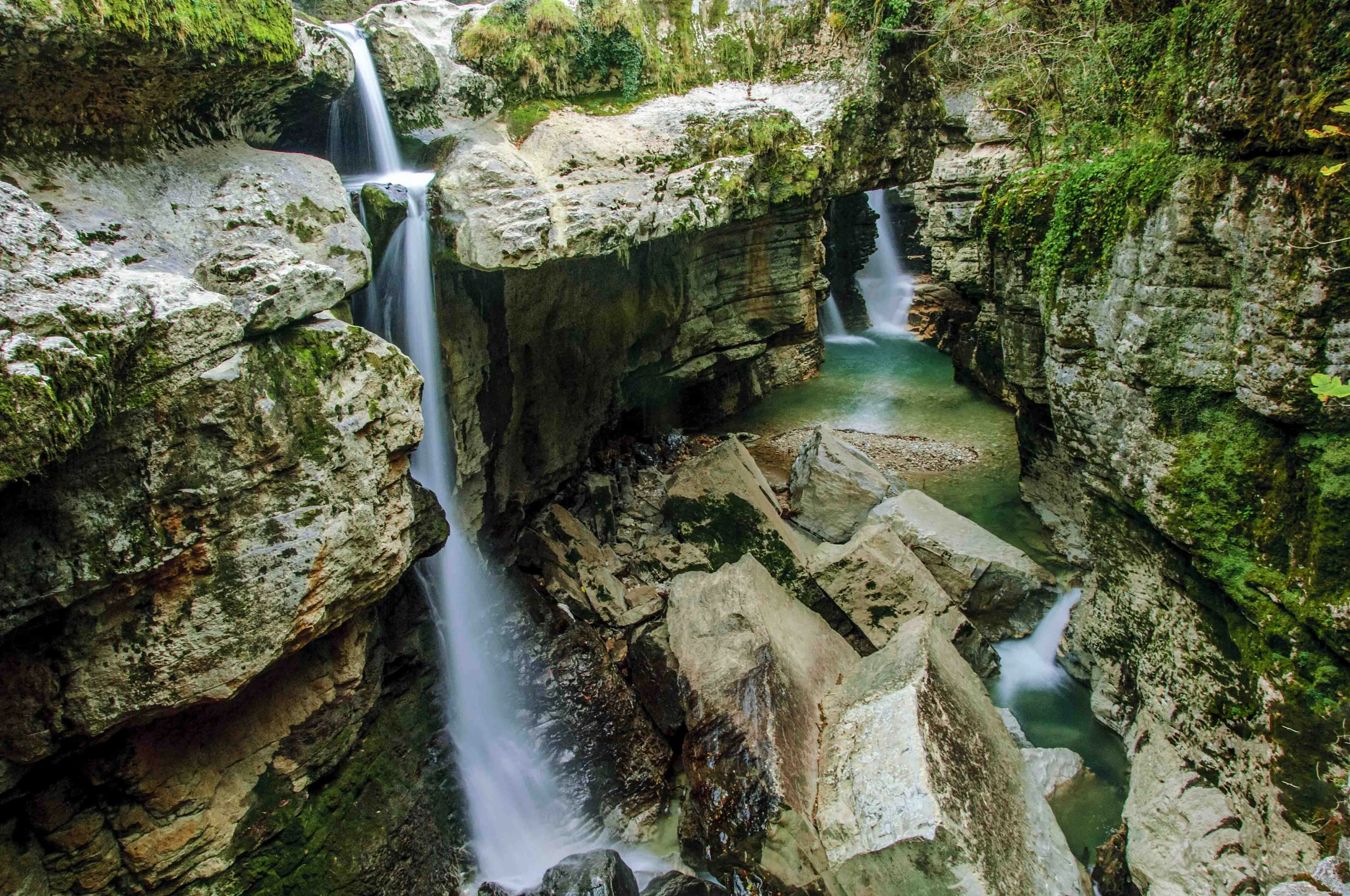
Martvili Canyon (also called Gachedili Canyon) has become one of Georgia’s most popular natural attractions. The Abasha River has carved a spectacular gorge through limestone over millions of years, creating turquoise pools, waterfalls, and sheer cliff walls draped in moss and ferns.
The canyon sits within a broader protected area that includes Colchic forest remnants. The site has been developed for tourism with walking paths, viewing platforms, and boat services.
Two sections to explore:
Upper Canyon (walking trail):
- Length: 700 meters one way
- Duration: 30 to 40 minutes
- Features: Suspended walkways, waterfall viewpoints, lush vegetation
- Difficulty: Easy, suitable for families
Lower Canyon (boat tour):
- Length: 300 meters by boat, then 300 meters walking
- Duration: 15 to 20 minutes on water
- Features: Rowing through a narrow gorge with 40-meter cliffs, emerald pools
- Boat capacity: 4 to 6 people per boat
When to go: April to October for best conditions. Spring (April to May) offers fuller waterfalls after snowmelt. Summer is warmest but most crowded. Autumn brings smaller crowds and golden foliage. The canyon is open year-round but boat tours may be suspended during high water.
Combine with: Prometheus Cave, Okatse Canyon, Kinchkha Waterfall (all within 1 to 1.5 hours drive)
Kolkheti National Park and Lake Paliastomi
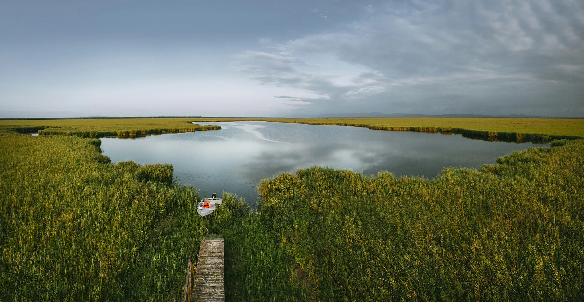
Kolkheti National Park protects Georgia’s most significant wetland ecosystem along the Black Sea coast. The park earned UNESCO World Heritage status in 2021 as part of the “Colchic Rainforests and Wetlands” inscription, recognizing its global importance for biodiversity.
The park spans 44,613 hectares across five administrative districts (Zugdidi, Khobi, Senaki, Abasha, and Lanchkhuti), encompassing both the historic regions of Samegrelo and Guria.
Lake Paliastomi:
Lake Paliastomi is the heart of Kolkheti National Park and one of Georgia’s most important water bodies for birdlife. The lake covers approximately 18 square kilometers and connects to the Black Sea through a narrow channel, creating a unique brackish water ecosystem.
Key facts about Paliastomi:
- Surface area: 17.3 sq km
- Maximum depth: 3.2 meters
- Water type: Brackish (mix of fresh and salt water)
- Fish species: 30+ including mullet, carp, catfish
- Bird species: 190+ recorded, 90+ nesting
Why Paliastomi matters:
The lake and surrounding wetlands serve as critical habitat along the East Atlantic Flyway, one of the world’s major bird migration routes. During spring and autumn migrations, tens of thousands of waterfowl pass through. Species of note include:
- Dalmatian pelican: Globally vulnerable, regular visitor
- Pygmy cormorant: Significant breeding population
- White-tailed eagle: Winter visitor
- Ferruginous duck: Globally near-threatened
- Great white egret: Common, especially in autumn
- Glossy ibis: Regular during migration
Boat tours on Paliastomi:
The best way to experience the lake and wetlands is by boat tour organized through the national park visitor center in Poti.
Kvemo Kartli: Day Trips from Tbilisi
Kvemo Kartli offers the most accessible wilderness experiences near the capital. Within 60 to 90 minutes of Tbilisi, you can reach national parks, dramatic canyons, and medieval fortresses.
Algeti National Park
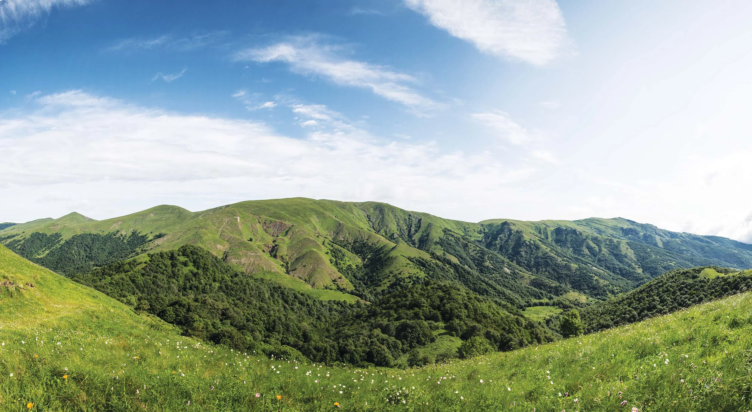
Algeti is the closest national park to Tbilisi, making it ideal for day trips or weekend escapes. The park stretches along the upper Algeti River valley on the southern slopes of the Trialeti Range, protecting one of the easternmost stands of Caucasian spruce and Nordmann fir in Georgia.
Botanists call Algeti a “floristic knot” because of its exceptional plant diversity. The park harbors over 1,600 plant species across just 6,822 hectares, including 80 tree species, 800 grass species, and several Georgian and Caucasian endemics. Wildlife includes roe deer, wild boar, fox, rabbit, and various raptors including eagles and falcons.
The park was established in 1965 as a Soviet nature reserve and reorganized as a national park in 2007.
Trails:
| Trail | Distance | Duration | Difficulty |
|---|---|---|---|
| Samepo Kedi (Royal Ridge) | 16 km loop | 6 to 8 hours | Moderate |
| Martalkhevi Loop | 8 km | 3 to 4 hours | Easy to Moderate |
| Visitor Center Nature Trail | 2 km | 1 hour | Easy |
Samepo Kedi (Royal Ridge): The park’s signature trail and the only fully marked route. The circular path starts from Manglisi, passes through mixed coniferous and deciduous forest, follows the scenic Royal Ridge with panoramic mountain views, and returns via the village of Didi Namtvriani. Blue and white blazes mark the route. A tourist shelter along the trail allows overnight stays (confirm the current shelter rate with the visitor centre).
Practical information:
| Detail | Information |
|---|---|
| Visitor center | Manglisi, Kurorti Street 4 |
| Distance from Tbilisi | 60 km (1 to 1.5 hours) |
| Elevation range | 1,100 to 2,000 m |
| Highest point | Mount Kldekari (2,000 m) |
| Trail registration | Free at visitor center |
| Shelter fee | Confirm the current rate with the visitor centre. |
| Camping fee | Confirm the current rate with the visitor centre. |
| Rope park (at visitor center) | Confirm the current rate with the visitor centre. |
| Horse riding | Available, inquire at visitor center |
| Coordinates | 41.7050°N, 44.3600°E |
At the visitor center: The Manglisi visitor center has a rope adventure park in its courtyard with courses for adults and families (10 to 14 obstacles). There’s also a picnic area with auxiliary buildings for day visitors who want to enjoy the setting without hiking.
Historical sites in and around the park:
Manglisi Cathedral (Assumption of the Virgin Mary): Located at the park entrance, this is one of Georgia’s oldest churches, with origins in the 4th century. According to tradition, it once housed a nail from the crucifixion cross of Christ.
Arsena’s Cave: About 1 km from Manglisi, this cave allegedly served as a hideout for Arsena Odzelashvili, Georgia’s legendary “Robin Hood” who fought against serfdom in the 19th century. Accessible only on foot.
Kldekari Fortress: Medieval fortress ruins at 2,200 meters elevation, accessible via a challenging 4×4 track through the park or from Tsalka Municipality via Choliani village. The fortress offers commanding views of the Trialeti Mountains.
When to go: April to October. Spring brings wildflowers and mild temperatures. Summer offers the best conditions for the Royal Ridge trek. Autumn colors peak in late September to October. The park remains accessible in winter but trails may be muddy or snow-covered.
Nearby Attractions: Birtvisi and Dashbashi
Two dramatic canyon systems lie within easy reach of Algeti, making excellent combinations for a full day of exploration.
Birtvisi Canyon and Fortress:
Birtvisi is a striking volcanic rock formation about 30 minutes drive from Manglisi. The canyon features towering rock pillars, caves, and the ruins of a medieval fortress perched on seemingly impossible cliffs.
- Hike to fortress: 2 km uphill, about 1 hour
- Features: Rock formations, fortress ruins, panoramic views
- Access: Paved road to parking area, then hiking trail
- Best for: Photography, light adventure hiking
Dashbashi Canyon:
Dashbashi Canyon has become famous for its “Diamond Bridge,” a glass-bottomed pedestrian bridge spanning the gorge at 240 meters height. The canyon itself is a dramatic gash in the volcanic plateau with waterfalls cascading down the walls.
| Detail | Information |
|---|---|
| Bridge length | 240 meters |
| Height above canyon | 140 meters |
| Entry fee | Privately operated; check the current ticket price before visiting. |
| Features | Glass floor sections, viewing platforms, waterfall views |
| Access from Tbilisi | 100 km, about 1.5 hours |
| Access from Manglisi | 40 km, about 45 minutes |
Practical Information
Registration and Permits
All national parks require free registration at visitor centers before hiking. For strict nature reserves, advance permission is needed from the Agency of Protected Areas.
Border zone requirements: Bring passport copies for parks near Russia, Azerbaijan, or Armenia (Lagodekhi, Vashlovani, Tusheti, Pshav-Khevsureti, Kazbegi Truso Valley).
Fees Vary by Park
Fees are not standard across Georgia’s protected areas. Many national-park trails are free, while caves, canyons and natural monuments may charge admission; shelter, camping, equipment, horse, transport and guide rates vary by park or supplier. Check the official National Parks of Georgia website and confirm with the relevant visitor centre before travel.
Agency of Protected Areas Contact
Central Office:
- Address: 6 G. Gulua Street, Tbilisi 0114
- Phone: +995 32 2 72 27 22
- Email: info@apa.gov.ge
- Website: apa.gov.ge
What to Pack
Essential for all parks:
- Layers for temperature changes
- Rain gear (essential for Adjara parks)
- Sturdy hiking boots
- Sun protection
- First aid kit
- Water purification
- Cash in Georgian Lari (cards rarely work in parks)
- Passport copy (for border zone parks)
Additional for multi-day treks:
- Sleeping bag (or rent at visitor centers)
- Headlamp
- Emergency shelter
- Enough food for all days plus one extra
Getting There Without a Car
Public marshrutkas reach towns near most major parks:
- Borjomi: Didube station, every hour
- Lagodekhi: Isani metro area, every hour
- Dedoplistskaro (for Vashlovani): Ortachala or Isani
- Stepantsminda (Kazbegi): Didube station, every 2 hours
- Mestia (Svaneti): From Zugdidi (marshrutka) or Natakhtari (flight)
Parks requiring 4×4 (Tusheti, Pshav-Khevsureti, Vashlovani safari routes) work best with organized tours.
Frequently Asked Questions
How many protected areas does Georgia have?
The official total changes as new sites are designated or reclassified. Georgia’s network includes national parks, strict nature reserves, managed reserves, natural monuments and protected landscapes; check the Agency of Protected Areas for the current inventory.
What is the difference between a national park and a nature reserve in Georgia?
National parks allow tourism and recreation while protecting ecosystems. Strict nature reserves prioritise scientific research and biodiversity conservation, so tourism is limited or may require permission; managed reserves allow controlled use under park management.
Which park is closest to Tbilisi?
Tbilisi National Park reaches the edge of the capital. Algeti National Park is about one hour south, while Kazbegi National Park is roughly three hours north by road.
Do I need a guide for Georgia’s protected areas?
Many national parks have marked trails suitable for independent hikers. A guide is strongly recommended for remote regions such as Tusheti, technical routes such as Mount Kazbek, border-zone trails and parks requiring 4×4 access, including Vashlovani.
Which park is best for wildlife?
Vashlovani offers strong opportunities to observe semi-desert wildlife, including jackals and wild boar. Lagodekhi and Borjomi-Kharagauli support brown bear, deer and chamois, although dense forest makes sightings less predictable.
Can I camp anywhere?
Use designated campsites where available and confirm the current fee and local rules with park rangers. Wild-camping restrictions vary by protected area, and sensitive habitats or border zones may have additional limits.
Which parks are open in winter?
Tbilisi, Algeti, the Imereti cave sites and Kolkheti are generally accessible year-round, subject to weather and operating schedules. High-mountain roads to Tusheti and Pshav-Khevsureti normally become impassable from autumn until late spring, so confirm conditions before departure.
What is the most beautiful protected area in Georgia?
It depends on the landscape you prefer: Tusheti combines mountain scenery, traditional villages and medieval towers; Kazbegi has Georgia’s most iconic alpine view; Vashlovani offers unusual semi-desert formations; and Svaneti pairs glaciers with UNESCO-listed heritage.
Explore with Local Guides
Highlander Travel has explored Georgia’s protected areas since 2011. Our guides know the trails, the wildlife, and the stories behind these landscapes.
Popular tours:
- Vashlovani and Signagi Tour: Safari in Georgia’s semi-desert
- Adventures and Trekking: Multi-day trips in Tusheti, Svaneti, and beyond
- Horse Riding in Tusheti: 4-day horseback adventure
- 2-Day Khevsureti Tour: Shatili fortress and mountain villages
Contact us to plan your protected area adventure.
Official admission and park-service prices were checked on 31 August 2026. Private transport, accommodation, guide and activity prices remain variable. Check the National Parks of Georgia website or the relevant visitor centre before travel.



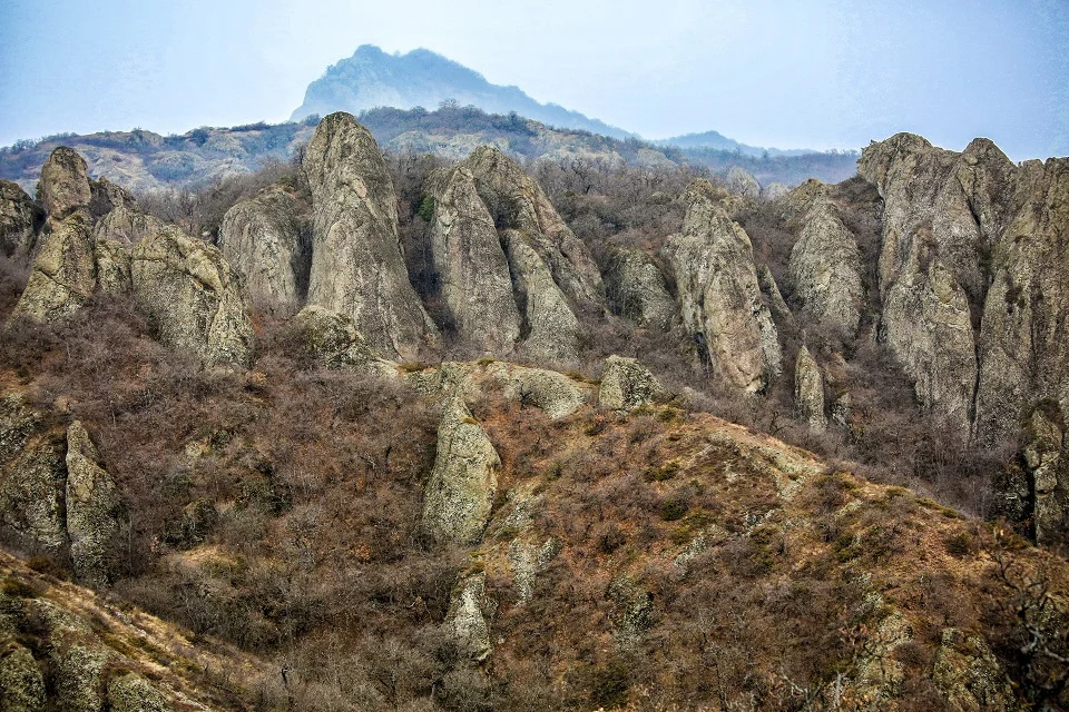
[…] in the far northeastern corner of Georgia’s Kakheti region, Lagodekhi National Park stands as one of the Caucasus’ most pristine wilderness sanctuaries. This spectacular protected […]
[…] road passes through Tbilisi National Park. The final approach is steep, so drive carefully and check road conditions during winter or wet […]
[…] The reserve was established in 1935 for a specific reason: to protect fossilized dinosaur footprints discovered two years earlier. This remains one of the few places in the world where tracks from both herbivorous and carnivorous dinosaurs are preserved at the same site. […]
[…] a wider overview, see our guides to the national parks of Georgia, hiking trails in Georgia and trekking in the […]
[…] See our complete guide to the 12 hiking trails in Borjomi-Kharagauli National Park and the wider overview of Georgia’s national parks. […]