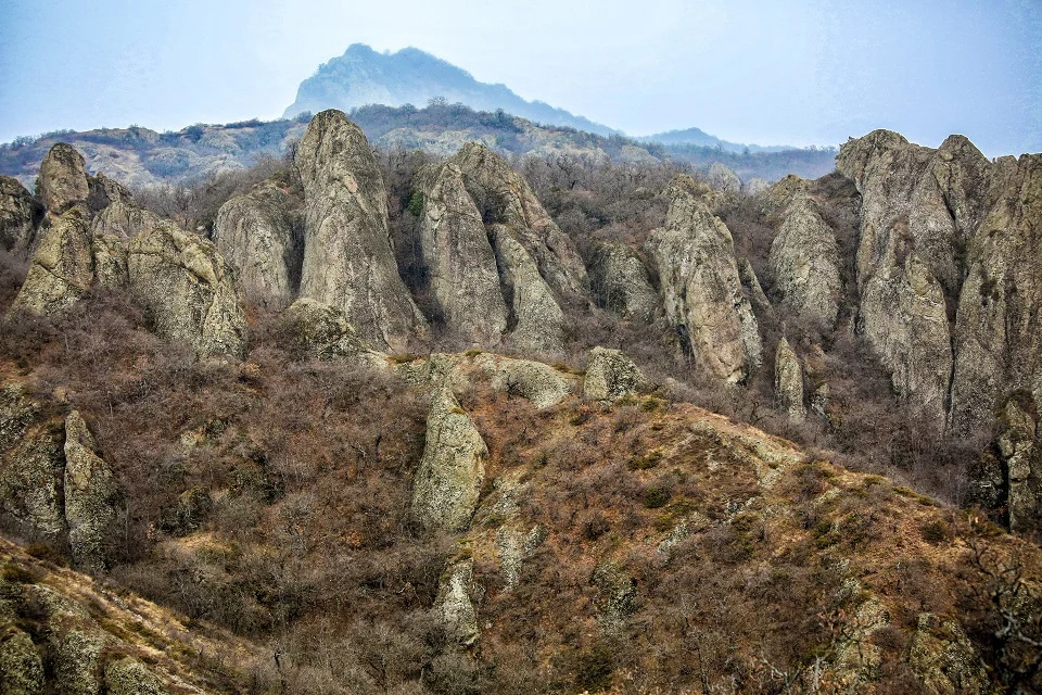
Birtvisi Canyon at a Glance
| Location | Tetritskaro Municipality, Kvemo Kartli |
|---|---|
| Distance from Tbilisi | Approximately 60–70 km |
| Main starting point | Village of Tbisi |
| Best-known attraction | Birtvisi Fortress and Sheupovari tower |
| Ordinary visit | Moderate-to-challenging fortress hike |
| Technical option | Guided canyoning with specialist equipment |
| Facilities | Very limited or absent on the trail |
| Entry fee | No standard ticket office for the hiking area |
What Makes Birtvisi Special?
Birtvisi is not a single viewpoint or conventional castle. The landscape itself formed much of the defence: volcanic rock towers, wooded ravines and narrow entrances created a natural fortress covering a broad area. Medieval builders added walls, gates, towers, living spaces and water-storage structures among the cliffs.The result feels more like a rock labyrinth than a standard historical monument. Trails pass through forest and tight gaps before reaching scattered ruins hidden among the formations. The combination of geology, wilderness and history is what sets Birtvisi apart from more accessible fortresses near Tbilisi.The History of Birtvisi Fortress
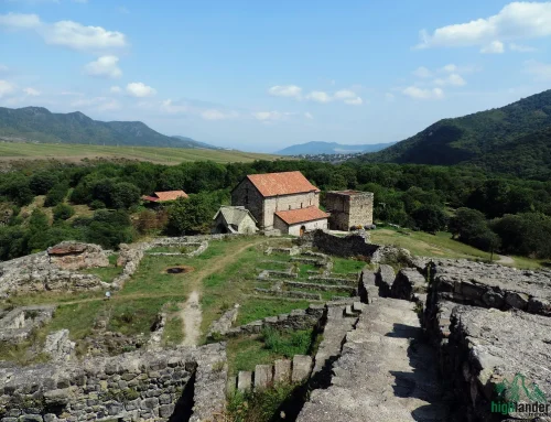
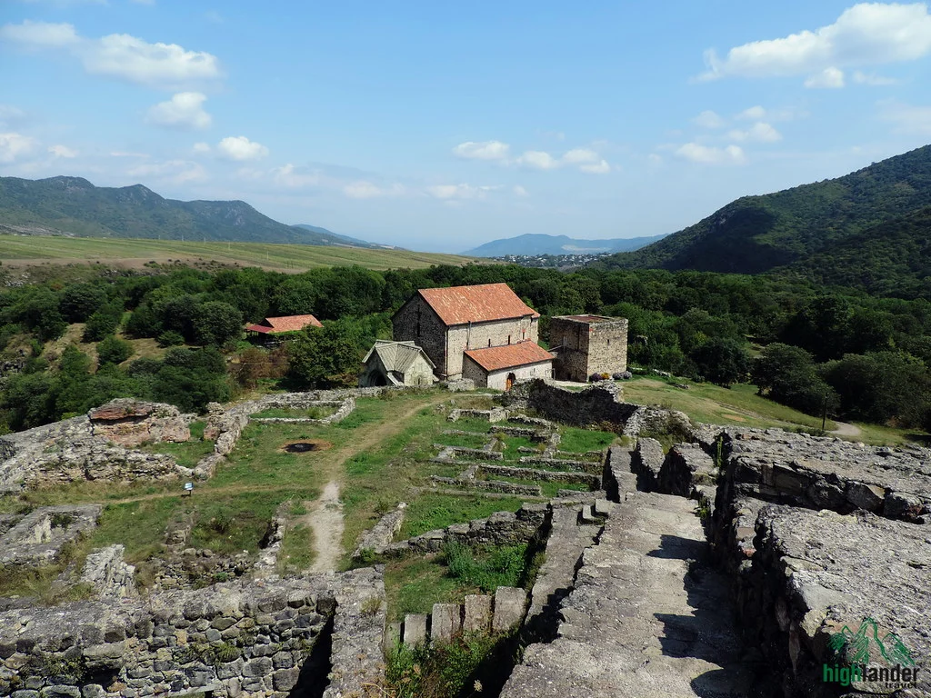
The exact construction date is unknown, but Birtvisi appears in written sources in the 11th century. Its position allowed its rulers to control routes through the Algeti gorge, while the cliffs made a direct assault exceptionally difficult.The fortress became known as one of medieval Georgia’s strongest defensive positions. Timur’s army eventually captured it in 1403 after earlier attempts had failed. Birtvisi later passed into the Kingdom of Kartli and remained associated with the Baratashvili princely family.Today, walls and other structures survive in ruined condition across the massif. The best-known feature is Sheupovari, a lookout tower positioned on a high rock. Reaching exposed or elevated ruins may require scrambling and should not be attempted when the rock is wet or by visitors uncomfortable with heights.Fortress Hiking and Technical Canyoning Are Not the Same Trip
| Experience | Fortress hike | Technical canyon route |
|---|---|---|
| Typical activity | Walking, uneven trails and some scrambling | Walking in water, swimming and rope-assisted sections |
| Guide | Strongly recommended for first-time visitors | Essential; use a competent technical canyoning operator |
| Equipment | Hiking footwear, navigation and seasonal clothing | Helmet, harness, ropes, suitable thermal protection and technical safety gear |
| Water exposure | Usually avoidable on the standard overland route | Continuous or repeated water exposure |
| Suitable for | Fit hikers comfortable on rough terrain | Strong swimmers with suitable fitness and no serious fear of heights |
| Weather sensitivity | Wet rock makes the trail slippery | Rain and changing water levels can make entry unsafe |
The Birtvisi Fortress Hike
The most common approach begins near the village of Tbisi. From there, the route enters a landscape of woodland and rock formations before passing through a narrow gap often called Devi’s Footprint. Paths branch within the massif, and signage may be limited, which makes offline navigation or a knowledgeable guide valuable.A typical fortress outing involves around four to five hours of hiking, although the exact distance and duration depend on the chosen route, parking point, stops and whether the group attempts the higher ruins. Expect uneven ground, loose stones, fallen leaves, short steep sections and places where you may use your hands for balance.Who Is the Hike Suitable For?
The standard hike suits active travellers with reasonable fitness and confidence on rough terrain. It is not a smooth family promenade, and suitability for children depends on their hiking experience, the weather and the exact route. Visitors with mobility limitations will find the terrain difficult.You do not need technical canyoning equipment for a normal overland fortress hike, but sturdy footwear, enough water and reliable navigation are important. Avoid attempting exposed towers or steep scrambles simply because another group is doing so.Technical Canyoning at Birtvisi
The full canyon contains water-filled passages, small waterfalls, deep pools and obstacles that may require rope techniques. Some sections cannot be covered safely as a normal independent hike. Swimming ability alone is not enough: cold water, slippery surfaces, falling rocks, changing flow and limited exit options all affect risk.Only enter the technical canyon with an operator who has assessed conditions on the day and provides route-appropriate equipment. The operator—not a generic packing list—should decide whether wetsuits, ropes, helmets, flotation equipment or other protection are required for the season and water level.Pregnant travellers and people with significant heart, respiratory, joint or balance conditions should not book technical canyoning without medical advice and explicit discussion with the operator. Participants must disclose relevant health conditions before departure.Best Time to Visit Birtvisi
For the fortress hike, spring and autumn usually offer the most comfortable temperatures. Spring brings green forest but can also mean mud and higher water, while autumn combines cooler walking weather with changing foliage. Summer is possible, although exposed sections can become hot.Technical canyoning depends on current water level, rainfall and temperature rather than a fixed calendar date. Local guidance often favours late summer, when water may be lower, but this is never a guarantee of safe conditions. A competent operator should make the final go-or-no-go decision after checking the forecast and route.Avoid the canyon during or after heavy rain. Narrow gorges can concentrate water quickly, and wet volcanic rock becomes extremely slippery. Winter conditions can include cold water, ice and short daylight, making both hiking and canyoning more difficult.How to Get to Birtvisi from Tbilisi
Birtvisi is approximately 60–70 kilometres southwest of Tbilisi. The usual road approach runs toward Tetritskaro through Asureti, with a turn toward the village of Tbisi. Driving commonly takes around 1.5 hours, but traffic, road conditions and the final parking point affect the journey.Public transport is not convenient for a full hiking day because it may not reach the trailhead or match your return time. A private vehicle, prearranged driver or guided excursion is more practical. Download the location and route before leaving Tbilisi because mobile coverage can be unreliable around the rocks.What to Bring for the Fortress Hike
- Hiking shoes with dependable grip
- Weather-appropriate layers and a waterproof shell
- Enough drinking water for the full walk
- Lunch and energy snacks
- Sun protection and a hat
- A charged phone with an offline map
- A small first-aid kit and personal medication
- A headlamp in case the return takes longer than planned
- A bag for carrying all waste back out
Safety Checklist Before You Go
- Check the current forecast for Birtvisi and the surrounding Tetritskaro area.
- Do not enter the water canyon during or soon after heavy rain.
- Tell someone outside the group your route and expected return time.
- Carry an offline map and do not rely only on mobile reception.
- Start early enough to finish well before darkness.
- Turn back if the rocks are dangerously wet, water is higher than expected or the group is moving too slowly.
- Use a specialist guide for the technical canyon and verify the exact inclusions before paying.
- Keep the group together; do not split up among the branching ravines.
Responsible Travel at Birtvisi
Birtvisi has no urban cleaning service along the trail. Carry out every item you bring, including food packaging and tissues. Avoid lighting fires in dry conditions, damaging vegetation, carving rocks or moving stones from historical structures.Camp only on durable, previously used ground and follow any current restrictions issued by the protected-area administration. Use biodegradable products away from streams and leave fortress walls exactly as you find them.What to See Near Birtvisi
- Algeti National Park: Forest landscapes and hiking opportunities in the Trialeti Range. Check current trail information before visiting.
- Manglisi: A historic highland town known for Manglisi Sioni Cathedral and its cooler summer climate.
- Asureti: A former German settlement with surviving architectural traces and an unusual chapter of regional history.
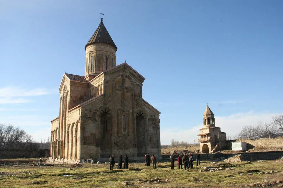
- Samshvilde: An extensive ruined fortress-city on a naturally defended plateau between river canyons.
- Tsalka and Dashbashi: A separate canyon area farther west, best treated as another excursion rather than a rushed addition to a long Birtvisi hike.
Planning a Birtvisi Day Trip
- Leave Tbilisi early and drive to the agreed trailhead near Tbisi.
- Begin the fortress hike after checking weather, water and trail conditions.
- Explore the accessible ruins without attempting unsafe exposed climbs.
- Stop for a packed lunch in a durable resting area and carry all waste out.
- Return to the vehicle with a generous daylight margin.
- If time allows, stop briefly in Asureti or Manglisi on the drive back.
Frequently Asked Questions
Where is Birtvisi Canyon?
Birtvisi is in Tetritskaro Municipality in Georgia’s Kvemo Kartli region, approximately 60–70 kilometres southwest of Tbilisi. The usual hiking approach begins near the village of Tbisi.
Is Birtvisi a canyon or a fortress?
It is both a dramatic natural rock landscape and the site of a medieval fortress complex. The cliffs and narrow passages formed natural defences that medieval builders reinforced with walls, towers and other structures.
Can I visit Birtvisi without canyoning?
Yes. Most visitors take an overland hike to the fortress ruins without entering the technical water canyon. The normal hike still includes rough terrain and may involve scrambling.
Do I need a guide for Birtvisi?
A guide is strongly recommended for first-time fortress hikers because paths branch and signage can be limited. A competent specialist guide is essential for the technical water-canyon route.
How difficult is the Birtvisi Fortress hike?
The hike is generally moderate to challenging. Expect several hours of walking on uneven ground, loose rock, steep sections and occasional use of your hands for balance.
Can non-swimmers visit Birtvisi?
Non-swimmers can take the standard overland fortress hike, provided they are comfortable with its terrain. They should not enter the technical canyon, which includes deep water and swimming sections.
What is the best time to hike at Birtvisi?
Spring and autumn usually provide comfortable hiking temperatures, though rain can make rocks slippery. Summer is also possible with an early start and sufficient water. Always check current weather before departure.
Is technical canyoning at Birtvisi safe after rain?
No route should be assumed safe during or soon after heavy rain. Narrow gorges can concentrate water quickly, so a qualified operator must assess current rainfall, flow and route conditions before entry.
How long does a Birtvisi day trip take?
Allow a full day from Tbilisi. The drive often takes around 1.5 hours each way, while a typical fortress hike may take approximately four to five hours depending on the route and group pace.
Is there an entrance fee at Birtvisi?
There is no standard ticket office for the general hiking area. Guided transport, specialist canyoning, equipment or other arranged services are priced separately by the operator.